Head of Department - Digital Engineering
Murphy Geospatial
The Role
Overview
Lead Digital Engineering team in Ireland, overseeing strategy, sales, operations and people.
Key Responsibilities
- proposal prep
- software research
- quality systems
- billing collection
- risk management
- project scheduling
Tasks
-Facilitate business growth by working together with clients as well as business partners (suppliers, subcontractors, JV partners, technology providers, etc.). -Build and maintain relationships with key clients to support repeat business and long-term partnerships -Oversee departmental budget, including sales targets and cost control -Support human resource processes within the department around recruitment, performance management, employee relations etc. -Maintain regular communications with the team to ensure project plans are progressing to schedule and problems are being resolved as they arise -Ensure legal and contractual compliance, including awareness of Irish law -Create and manage sales and marketing plans to support growth -Set clear goals and track performance against financial and operational targets -Provide Input into performance appraisals and final sign off on remuneration agreements -Work closely with external clients and employees with regards various projects, reporting requirements and maintenance of required documentation -Maintain client engagement throughout project delivery -Ensure compliance with all regulations and internal policies -Promote a safety culture and ensure any learnings from near misses or accidents are implemented -Prepare and review technical and commercial proposals aligned with client needs and operational capabilities -Support billing, cash collection, and risk management processes -Promote positive engagement into the use and development of Quality Systems -Support organisational change initiatives as they are rolled out across the business with department managers -Provide training and guidance to the team in exercising their roles and responsibilities -Develop and implement departmental strategy aligned with company objectives -Provide input and support to other departments as they seek to implement improvements that will benefit the Company -Build trusting relationships by acting with integrity, courtesy, and responsibility, even in the face of stress or demanding workplace conditions -Identify new business opportunities -Lead research and adoption of new software and equipment -Lead dispute resolution and apply lessons learned to improve future delivery -Participate on the safety committee -Ensure proposals meet internal pricing, compliance, and delivery standards
Requirements
- revit
- navisworks
- cdes
- iso 19650
- degree
- 7+ years
What You Bring
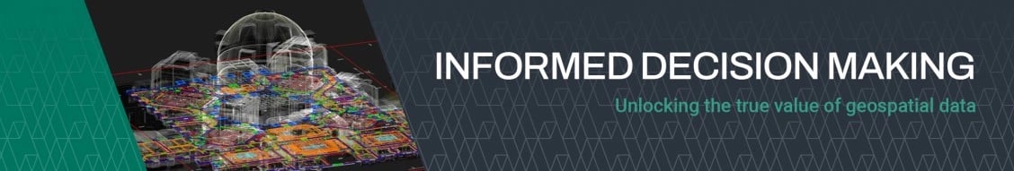
Murphy Geospatial captures, collates, verifies and governs geospatial data, enabling our clients to make informed decisions across the project lifecycle. Proven geospatial solutions through design, construction and inuse phases of projects across six key sectors; Infrastructure, Manufacturing, Energy, Utilities, Property and Natural Environment. The ideal candidate will bring strategic vision, leadership experience, and a proven ability to identify and capitalize on business opportunities within the digital engineering landscape. We are currently seeking a Head of Department to lead our Digital Engineering team in Ireland. This is an exciting opportunity for a dynamic professional with a strong background in Digital Engineering operations and a passion for driving sales growth. Murphy Geospatial HR Philosophy -Knowledge of ISO 19650 standards and BIM procedures -Good understanding of construction processes and sequencing -Ability to communicate technical information effectively -Strong leadership and decision-making skills -Commercial awareness and strategic thinking -Hold a full IRE driving licence -Work effectively with all levels of management and employees, showing respect for deadlines, collaborative problem solving and honest communication -Right to work in Ireland -Comfortable working in a fast-paced environment. -Proven experience in performance, sales and operations management -Strong policy writing and strategic planning experience -Strong working knowledge of Revit, Navisworks, CDEs, and digital workflows -Excellent commercial awareness -Effective communicator with strong interpersonal and negotiation skills -7+ years of geospatial and engineering management experience -Proven ability to manage and develop high-performing teams -Skills that enable collaboration and communication, including the use of Microsoft Office, Microsoft Project -Excellent time and priority management -Degree in Geomatics, Engineering, or related field
People Also Searched For
Mechanical Engineer jobs in Bray , Leinster , IE
Quality Engineer jobs in Bray , Leinster , IE
Quality Assurance jobs in Bray , Leinster , IE
Mechanical Engineer jobs in Leinster , IE
Quality Engineer jobs in Leinster , IE
Quality Assurance jobs in Leinster , IE
Mechanical Engineer jobs in Bray , IE
Quality Engineer jobs in Bray , IE
Quality Assurance jobs in Bray , IE
Benefits
Want a role with constant opportunity for upskilling and progression? Founded in 1983, our highly developed workflows have been refined through the delivery of over 27,000 projects over 40 years. The Murphy Geospatial and Woolpert union enables numerous career growth and training opportunities within the business. Would you like to be part of our winning team and get the opportunity to work on a variety of high-profile projects across the UK, Europe and the US? -Exclusive Clients: We are proud to work with a broad spectrum of exclusive clients. -Support network: We pride ourselves on our excellent support network of employees and management who are always eager to help each other. -Breadth of Experience: We branch across all sectors of industry giving our staff opportunities to gain a broad base of knowledge and experience.
The Company
About Murphy Geospatial
-Its expertise spans infrastructure, construction, utility networks, manufacturing sites, and natural environment assessments. -It pioneers advanced tools such as GeoDrive, laser scanning, subsurface engineering, and 3D digital twin development. -Clients benefit from end-to-end geospatial services, including aerial/drone surveys, topographic and property surveys, BIM, asset monitoring, and GIS. -The company’s GeoDrive technology offers cost-effective and highly detailed data collection solutions. -They seamlessly integrate traditional surveying techniques with cutting-edge reality capture and digital twin technologies to drive data-driven decision-making.
Sector Specialisms
Infrastructure
Manufacturing
Utilities
Property
Energy
Natural Environment
Commercial
Residential
Logistics
Retail
Industrial