Professional Land Surveyor
R. Joe Harris & Associates, Inc.
The Role
Overview
Perform land surveys for development projects, collaborate with engineers, and mentor staff.
Key Responsibilities
- survey lead
- gps surveying
- autocad drafting
- boundary survey
- survey data
- mentor staff
Tasks
-Lead surveying for land development and civil site work projects, from boundary surveys to construction staking. -Utilize GPS, robotic total stations, AutoCAD, and Civil 3D for efficient, high-quality deliverables. -Mentor and guide junior staff while serving as a technical resource for project teams and clients. -Work on impactful land development projects that shape communities. -Collaborate closely with civil engineers during planning, design, permitting, and construction phases. -Conduct boundary topographic, and ALTA/NSPS surveys; prepare plats, easements, and legal descriptions. -Provide survey data that supports grading plans, utilities, stormwater systems, and roadway design.
Requirements
- communication
- licensure
- autocad
- civil 3d
- gps/gnss
- surveying degree
What You Bring
-Strong communication skills and ability to collaborate with engineers, clients, and stakeholders. -Licensed or able to obtain licensure in South Carolina. -Proficiency in surveying technology, AutoCAD, Civil 3D, and GPS/GNSS systems. -Bachelor's Degree in Surveying, Geomatics, or related field. -2+ years of land surveying experience, ideally with land development and site design projects.
People Also Searched For
Project Coordinator jobs in Rock Hill , South Carolina , US
HVAC Supervisor jobs in Rock Hill , South Carolina , US
Site Manager jobs in Rock Hill , South Carolina , US
Project Coordinator jobs in South Carolina , US
HVAC Supervisor jobs in South Carolina , US
Site Manager jobs in South Carolina , US
Project Coordinator jobs in Rock Hill , US
HVAC Supervisor jobs in Rock Hill , US
Site Manager jobs in Rock Hill , US
Benefits
-Competitive compensation and full benefits package [health insurance, PTO, and more]. -Collaborative environment where surveyors and engineers work hand-in-hand. -Opportunities for professional growth and development.
The Company
About R. Joe Harris & Associates, Inc.
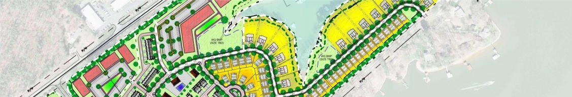
-Over the years it grew steadily, blending meticulous land surveying with infrastructure design across residential, commercial and municipal sectors. -Their portfolio spans master‑planned communities, pump stations, roadways, stormwater systems and flood studies throughout the Charlotte/York County region. -The company’s dual‑department setup—civil engineering and land surveying—allows seamless collaboration on multi‑phase, complex projects. -Typical engagements include boundary and topographic surveys, wastewater and water‑system modeling, and site development for industrial and commercial builds. -They’ve led signature regional projects like the Rock Hill Operations Center and upscale communities such as Habersham and Walnut Creek. -Their financial footprint remains modest but resilient, supporting mid-sized revenue from specialized engineering and surveying services. -An unusual fact: although small in size, they marshal both legal‑precision land mapping and technical infrastructure planning under one roof.
Sector Specialisms
Municipal
Residential
Commercial
Industrial
Visa Sponsorship
-no visa sponsorship offered; candidates must be legally authorized to work in the u.s. without sponsorship now or in the future.